


The Formation of the Amu Darya: A Geographical and Historical Overview
The Amu Darya is one of the largest rivers in Central Asia and has served as a vital source of life and culture in the region since ancient times. Its formation, course, ecological status, and historical significance show that this river plays a key role not only geographically, but also economically and culturally.
Geographical Origin of the Amu Darya
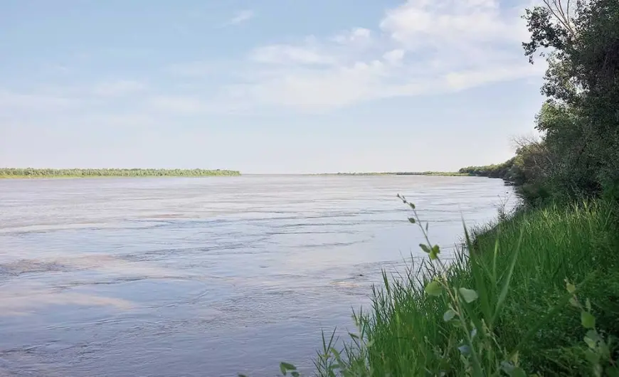
The Amu Darya is formed by the confluence of two major rivers — the Panj (also sometimes called Wakhan) and the Vakhsh, both originating from the northern slopes of the Hindu Kush mountains. The point of their confluence is located in present-day Kelif, Tajikistan. From there, the river is known as the Amu Darya and flows northeast, forming part of the border between Uzbekistan and Turkmenistan, crossing the Karakum Desert and eventually reaching the former Aral Sea.
Length and Flow of the Amu Darya
The Amu Darya has a total length of about 2,540 kilometers, although its flow has significantly changed in modern times. Historically, the river reached the Aral Sea, but due to irrigation canals and climate changes, much of its water is now diverted before it can reach the sea — or it reaches it in very small quantities. The majority of the river’s flow is now used for irrigation in countries along its course: Tajikistan, Uzbekistan, Turkmenistan, and Afghanistan.
Historical Significance
In ancient times, the Amu Darya was known as the Oxus. This name appears in Greek and Persian historical sources. Civilizations such as Khwarezm, Bactria, and Sogdiana developed along its banks. Great cities and cultural centers flourished in the region. The Amu Darya also formed a crucial part of the Silk Road, serving as a crossroads for various cultures and religions.
Ecological Condition and Challenges
Since the second half of the 20th century, the Amu Darya and its destination, the Aral Sea, have faced a severe ecological crisis. During the Soviet era, large-scale irrigation systems — especially the Karakum Canal, Amu-Bukhara Canal, and others — diverted significant volumes of water. As a result, the Aral Sea began to dry up, and the Amu Darya could no longer reach it consistently. This led to desertification, increased dust storms, soil salinization, and public health issues in the surrounding regions.
Current State of the Amu Darya
Today, the Amu Darya is used by several countries. Tajikistan, located in the river's upper reaches, uses its waters for hydroelectric power generation. Uzbekistan and Turkmenistan rely heavily on the river for irrigation and agricultural purposes. Afghanistan is also building new infrastructure to utilize its share of the Amu Darya's water.
Currently, the river does not reach the Aral Sea as it once did. This situation has raised international concern and has brought attention to issues like fair water distribution, ecological restoration, and regional cooperation.
The Amu Darya is not merely a geographical feature. It holds immense importance in historical, economic, and ecological contexts. Its formation and development are closely tied to the cultural evolution of Central Asia. Addressing the challenges facing the Amu Darya requires international cooperation, sustainable environmental practices, and global efforts to combat climate change.